Project & Dataset
2026
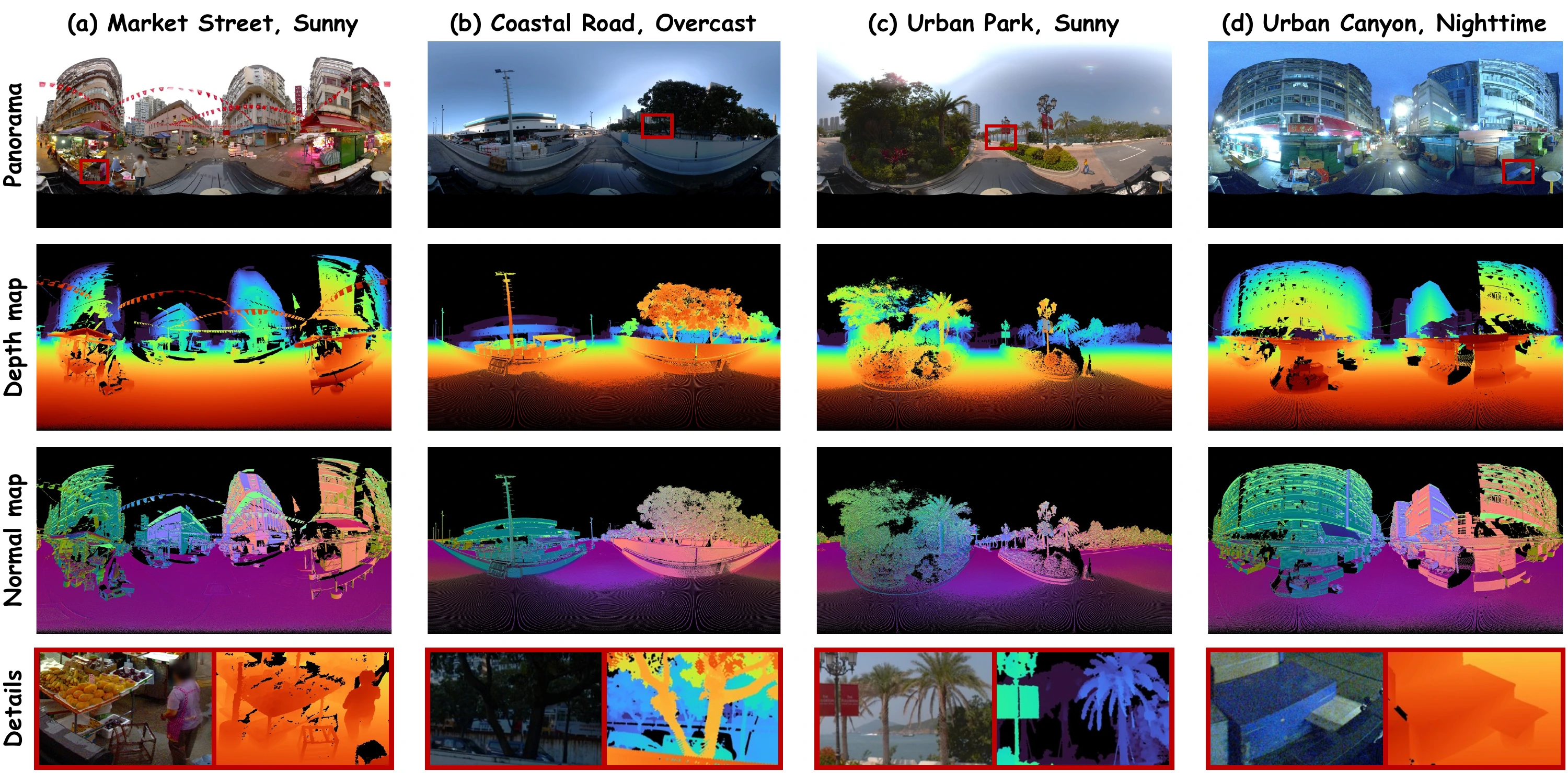
PanoHK360: A Large-Scale 8K Urban Panoramic Dataset and Benchmark for Depth Estimation
Yunxiao Chen, Honghuan Lin, Ruisheng Wang, Yujun Liu, Kun Zhou, Shangfeng Huang, Tsz Nam Chan
PanoHK360 pairs approximately 2 million 8K urban panoramas from Hong Kong with survey-grade LiDAR depth and provides a benchmark for 360° depth estimation.
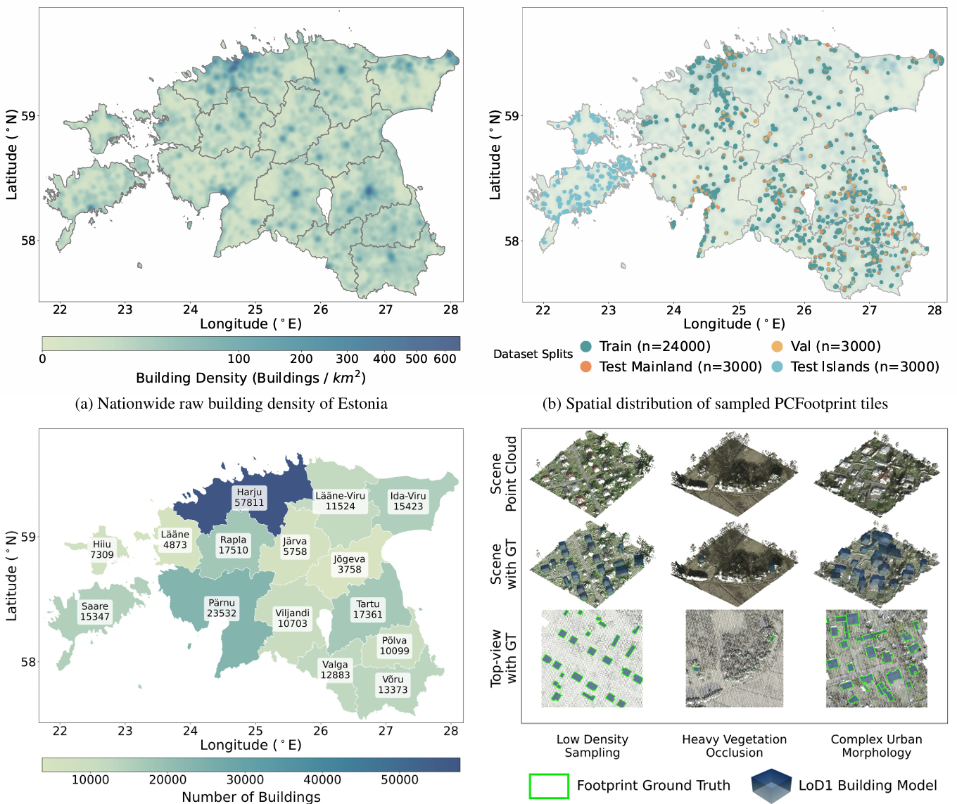
PCFootprint: A Large-Scale Dataset and Benchmark for Vectorized Building Footprint Extraction from Aerial LiDAR Point Clouds
Haoyuan Shen, Kuihao Wang, Ruisheng Wang, Yujun Liu
PCFootprint provides a large-scale benchmark for vectorized building footprint extraction from aerial LiDAR point clouds, with 33,000 tiles and 227,264 building instances across urban and rural landscapes in Estonia, including a 3,000-tile cross-domain test set.
2025

BuildingWorld: A Structured 3D Building Dataset for Urban Foundation Models
Shangfeng Huang, Ruisheng Wang, Xin Wang
BuildingWorld provides a large-scale, structured 3D building dataset about 5 million building models enabling robust urban foundation models across diverse regions, typologies, and real–synthetic modalities
2023

Building3D: An Urban-Scale Dataset and Benchmarks for Learning Roof Structures from Point Clouds
Ruisheng Wang, Shangfeng Huang,, Hongxin Yang
The first and largest urban-scale building modeling dataset. It consists of aerial LiDAR point clouds, mesh and wireframe models.